
Most drivers open Google Maps to reach a destination. In one part of India, local authorities rely on the same application for a different purpose. Police officers in Goa have integrated Google’s navigation platform into daily traffic monitoring in an effort to identify congestion as it develops.
A dedicated Traffic Response and Congestion Control center keeps track of information displayed in Google Maps. Officers pay particular attention to roads highlighted in red. According to local police representatives, those markings help identify locations suffering from heavy traffic and major slowdowns. Once such areas appear on the map, personnel are dispatched to address the congestion directly.
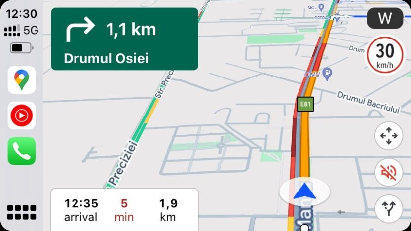
The system itself is simple. Green lines indicate smooth traffic flow with no delays. Orange sections point to moderate traffic conditions and slower movement. Red remains the color authorities focus on most closely. Those stretches signal congestion severe enough to attract immediate attention from traffic officers.
The monitoring effort extends beyond navigation data. Local police also review reports shared on social media platforms, including Facebook groups where road users discuss traffic violations. Together, these information sources have produced measurable results.
Authorities reported resolving 4,592 cases linked to traffic slowdowns caused by heavy traffic after reviewing Google Maps information. Separately, police filed 731 violation reports based on information gathered through social media monitoring.
Part of Google’s advantage comes from community participation. Since 2019, mobile users have been able to submit road reports directly through Google Maps. The company expanded the reporting system to Android Auto and CarPlay in 2024. Drivers now contribute information about accidents, roadworks, traffic jams, and other hazards while traveling.
The approach resembles Waze, a platform built largely around community-generated traffic information. Waze users regularly report blocked lanes, malfunctioning traffic lights, and numerous other road issues. Both services depend on verification from other users before reports gain wider visibility, helping keep information current.
Yet user submissions represent only part of the picture. Google also gathers traffic information automatically from smartphones running its applications. By analyzing location data, movement patterns, travel methods, and time spent in slow-moving traffic, the company estimates where delays are occurring. Those calculations feed directly into the familiar color-coded traffic layer visible in Google Maps.
What started as a navigation tool has gradually evolved into a broader traffic-monitoring platform. In Goa, police have already shown how data originally intended for drivers can also help manage congestion on a larger scale. The same red lines many motorists try to avoid have become indicators guiding officers toward the places needing attention most.